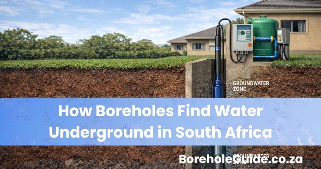
One of the most common questions homeowners ask before drilling is this: how do boreholes actually find water underground?
It is a fair question, because from the surface it can look almost impossible. There is no obvious underground river visible from your garden. There is no giant water tank under every property. Yet borehole drillers often know where to position a hole, how deep to go, and what signs may point to a better water strike.
The answer is that boreholes do not “find” water through luck alone. They find water by targeting the underground zones where groundwater is most likely to occur and move. In South Africa, that usually means looking for water stored in aquifers, weathered zones, fractures, fissures, joints, faults, or water-bearing rock formations. A borehole is drilled to intersect one or more of these favourable zones so that groundwater can flow into the hole and then be pumped to the surface.
That is why drilling a borehole is not the same as blindly drilling anywhere on the property and hoping for the best. A good drilling decision is based on geology, topography, local borehole knowledge, groundwater science, and in some cases a geophysical survey.
If you are still early in your research, it also helps to read Signs Your Property Has Groundwater in South Africa. That article explains the visible clues on the surface. This article goes deeper and explains what is happening below the surface and how drillers decide where groundwater is most likely to be found.
In this guide, you will learn what groundwater actually is, where it sits underground, how aquifers work in South Africa, how drillers choose promising targets, what tools they use, and why some boreholes succeed while others disappoint.
Table of Contents
- Quick answer: how boreholes find water
- What groundwater actually is
- Where underground water sits
- How aquifers work in South Africa
- Why rock type matters
- How drillers choose a borehole position
- What tools are used to find groundwater
- What happens during drilling
- Why some boreholes fail to find enough water
- What homeowners should know before drilling
- Final thoughts
- FAQs
Quick Answer: How Boreholes Find Water
Boreholes find water by drilling into underground zones where groundwater is stored or moving.
That usually means targeting:
- water-bearing aquifers
- fractures and fissures in rock
- weathered rock layers
- contacts between different rock types
- alluvial or sandy water-bearing formations
- low-lying or recharge-favoured geological areas
In practice, drillers do not simply “search for water” like treasure hunters. They use evidence. That evidence can come from local geology, nearby successful boreholes, the shape of the land, hydrogeological maps, and geophysical surveys that help identify subsurface features likely to hold or transmit groundwater.
So the short answer is this: boreholes find water by intersecting underground formations that can store and transmit groundwater.
What Groundwater Actually Is
Before you can understand how a borehole finds water, you need to understand what groundwater is.
Groundwater is water stored below the surface in soil, sand, gravel, weathered rock, pores, cracks, fractures, and aquifers. It usually comes from rainfall that infiltrates the ground over time instead of running off completely into rivers, dams, or stormwater channels.
Many people imagine groundwater as a giant underground lake. In a few special situations, underground cavities can store significant water, but that image is usually misleading. In most cases, groundwater is held in countless small spaces within the underground material.
That means a borehole is not normally drilling into an open cave full of water. It is drilling into material that contains water or into fractures that carry water.
This distinction matters because the real goal is not just to reach “wet ground.” The goal is to intersect a zone that can supply enough water at a usable rate. That is why a borehole can reach groundwater and still produce a weak result if the formation cannot transmit enough water into the borehole.
This also links directly to your live yield guide: How Much Water Can a Borehole Produce in South Africa?. Finding groundwater is one thing. Finding enough groundwater for your needs is another.
Where Underground Water Sits

Groundwater usually sits in one or more of the following places:
1. In pores between soil or sediment particles
In sandy or gravelly formations, water can occupy the spaces between particles. These are often called intergranular aquifers.
2. In fractures and fissures in hard rock
In much of South Africa, groundwater is commonly found in fractures, joints, faults, and fissures in otherwise hard rock. This is especially important because many South African boreholes rely on fractured-rock groundwater systems rather than large soft-sediment aquifers.
3. In weathered zones above hard bedrock
As rock breaks down over time, a weathered layer can form near the surface. This zone may hold groundwater and sometimes connects to deeper fracture systems.
4. In karst or dissolution features
In certain rock types such as dolomite, groundwater may be stored and move through solution cavities and channels.
So when a borehole “finds water,” it is really drilling into one or more underground zones that store or transmit groundwater well enough to support a borehole.
How Aquifers Work in South Africa
An aquifer is an underground formation that can store and transmit groundwater well enough to supply a borehole or a spring. That does not mean every aquifer is equally strong. Some have better storage. Some have better flow. Some produce excellent yields. Others produce only modest or poor yields.
In South Africa, aquifers vary widely by geology and region. A very important point is that much of the country is underlain by hard-rock aquifers, which means groundwater is often controlled by fractures and weathered zones rather than by broad, loose sandy formations.
That is one reason borehole success can vary so much from one property to another. Even two nearby properties can have different results if one hole intersects a productive fracture zone and the other misses it.
This also explains why local knowledge matters so much. If nearby properties have good boreholes, that often suggests the local geology is capable of supplying groundwater, even if the exact yield varies from site to site.
If you want the surface-level clues that often support this underground picture, your live article Signs Your Property Has Groundwater in South Africa fits naturally here.
Why Rock Type Matters
One of the biggest factors in borehole success is the type of rock or underground material beneath the property.
Different rock types affect:
- how much water can be stored
- how quickly water can move
- how deep a driller may need to go
- whether fractures are likely to be productive
- whether yields are likely to be strong or weak
Fractured hard rock
In many South African settings, groundwater occurs in fractures and joints in hard bedrock. These fractures act as conduits for water movement. A successful borehole often depends on intersecting the right fracture or fracture network.
Weathered rock zones
Weathered zones can store water and sometimes feed deeper fractures. In some cases, the transition between weathered rock and fresher bedrock becomes an important target.
Alluvial and sandy deposits
In some areas, especially along rivers or in certain coastal or sedimentary environments, groundwater may occur in intergranular aquifers where water occupies spaces between grains.
Dolomite and karst areas
Some formations can develop cavities or channels through dissolution. These may store and move water very effectively, but they also create special geological conditions that need proper understanding.
This is why the same drilling depth does not mean the same result everywhere. Fifty meters in one geological setting may produce excellent water. Fifty meters in another may produce very little.
How Drillers Choose a Borehole Position
Good drillers do not just pick a random point and start drilling. They try to choose the most promising target available based on the information they have.
1. They study the shape of the land
Topography matters. Low-lying areas, foot slopes, drainage lines, and certain landscape transitions may be more promising than exposed ridges or unfavourable high ground.
2. They look at local borehole success
If nearby properties have productive boreholes, that is useful evidence. Depth, yield, and water quality from surrounding boreholes can all help build a clearer picture of local groundwater potential.
3. They consider geology
Geological maps and local experience can help identify rock types, fracture-prone zones, and formations that are more likely to yield groundwater.
4. They identify possible structural features
Fracture zones, faults, contacts between rock units, and lineaments can all become targets because they may act as groundwater pathways.
5. They may use a geophysical survey
In some cases, geophysical methods are used to help detect subsurface contrasts that may indicate weathered zones, fractures, or other promising groundwater features.
All of this shows that borehole siting is usually a probability exercise, not a certainty exercise. A driller is trying to improve the odds by targeting the most favourable underground conditions.
What Tools Are Used to Find Groundwater

Different projects use different levels of investigation, but the main tools used to find groundwater may include the following:
Geological maps
These help identify the main rock types in the area and whether they are likely to support groundwater through pores, weathered zones, fractures, or karst features.
Hydrogeological maps
These provide groundwater-related information such as aquifer type, expected borehole performance, and regional groundwater conditions.
Nearby borehole records
Existing successful or unsuccessful boreholes in the surrounding area can be one of the most useful practical data sources.
Remote sensing and aerial interpretation
Satellite images, aerial photos, and landscape patterns may help identify lineaments, drainage alignments, vegetation anomalies, or structural features worth investigating.
Geophysical surveys
These surveys can help identify subsurface zones that differ in electrical or physical properties and may represent weathered zones, fractures, or water-bearing formations.
On-site inspection
Experienced drillers and hydrogeologists often combine all of the above with what they observe directly on the property.
| Tool | What It Helps With |
|---|---|
| Geological map | Understanding rock type and likely groundwater setting |
| Hydrogeological map | Understanding aquifers and groundwater potential |
| Nearby borehole data | Comparing local depth, yield, and success patterns |
| Remote sensing | Identifying lineaments, structures, and surface patterns |
| Geophysical survey | Finding promising subsurface targets |
| Site inspection | Bringing the evidence together on the actual property |
This is also why homeowners should be cautious of anyone who presents borehole drilling as pure certainty. Good groundwater targeting improves the chance of success, but it does not remove risk completely.
What Happens During Drilling
Once a drilling point has been chosen, the borehole is drilled downward through soil, weathered material, and rock until the driller reaches the target depth or encounters one or more water strikes.
A “water strike” usually means the drill has intersected a zone where groundwater enters the borehole. In fractured-rock settings, this may happen when the drill hits a productive fracture or fracture network. In other aquifer types, it may happen when the hole enters a water-bearing layer.
During drilling, the team may watch for:
- changes in rock type
- signs of weathered zones
- fracture zones
- water inflow
- depth of first water strike
- changes in drilling conditions that suggest a more favourable formation
But hitting water is still not the final answer. After drilling, the borehole still needs to be assessed for usable yield, recovery, and practical performance. This is why your live article How Borehole Drilling Works: Step-by-Step Guide is a natural internal link for readers who want the full process after groundwater targeting.
Why Some Boreholes Fail to Find Enough Water
This is one of the most important points for homeowners.
A borehole can be professionally sited and still produce a disappointing result. That does not always mean the process was poor. Groundwater is variable, and success is never guaranteed.
A borehole may fail or underperform because:
- the hole missed the most productive fracture zone
- the local aquifer has low transmissivity or poor yield
- the formation holds water but cannot transmit enough of it
- the borehole is too shallow for the target setting
- drought, recharge limits, or local overuse affect the aquifer
- the borehole was not properly tested and matched to realistic demand
This is exactly why “found water” and “found enough usable water” are not the same thing. A borehole may intersect groundwater and still not meet the needs of a full household.
That also connects directly to your live article Can Boreholes Run Dry in South Africa?. Even a borehole that once performed well can run into problems if the groundwater system is stressed, over-pumped, or poorly matched to demand.
What Homeowners Should Know Before Drilling
Homeowners do not need to become hydrogeologists, but they do need to understand the basics before spending money.
Groundwater is governed by geology
The rock and subsurface conditions below your property matter more than wishful thinking.
Visible signs help, but they are not proof
Green patches, healthy vegetation, damp areas, and local borehole success are useful clues, but they do not replace proper assessment.
Nearby boreholes matter a lot
Information from surrounding properties can often tell you far more than guesswork alone.
Depth is not everything
A deeper borehole is not automatically better. A productive target matters more than just chasing depth. Your live depth article, How Deep Should a Borehole Be in South Africa?, fits perfectly here.
Yield matters more than simply striking water
The borehole must produce enough water at a sustainable rate for your intended use. That is why yield testing and system planning matter after drilling.
Scientific methods reduce risk
They do not guarantee success, but they usually improve decision-making and borehole siting far more than random drilling.
For many property owners, this is also where cost decisions start to make more sense. If you understand that drilling is a scientific probability exercise rather than a guaranteed water strike, it becomes easier to understand why the full investment discussed in How Much Does a Borehole Cost in South Africa? needs to be approached carefully.
Final Thoughts
So, how do boreholes find water underground?
They find water by drilling into the underground formations that store and transmit groundwater. In South Africa, that usually means targeting aquifers, weathered zones, fractures, fissures, faults, or other favourable geological structures.
The process is not magic, and it is not purely luck. It is a combination of groundwater science, local knowledge, geology, landscape interpretation, and sometimes geophysical investigation.
That is also why not every borehole performs the same. The real challenge is not just drilling a hole. It is intersecting the right underground zone and finding a borehole that can supply usable water at a sustainable rate.
For BoreholeGuide readers, that is the key takeaway: underground water is found where geology allows it to be stored and move. The better the understanding of that geology, the better the odds of choosing a promising borehole target.
FAQs
Do boreholes drill until they hit an underground river?
Not usually. Most boreholes do not tap into an underground river. They usually intersect groundwater stored in pores, weathered zones, fractures, or aquifers.
How do drillers know where water is underground?
They use evidence such as geology, nearby boreholes, the shape of the land, hydrogeological information, and sometimes geophysical surveys to identify more promising targets.
What is a water strike in a borehole?
A water strike happens when the drill intersects a water-bearing zone and groundwater starts entering the borehole.
Can two neighbouring properties have different borehole results?
Yes. Groundwater conditions can change over short distances, especially in fractured-rock environments.
Is finding water the same as having a strong borehole?
No. A borehole may reach groundwater but still have a low yield if the formation cannot transmit enough water into the hole.
Why does geology matter so much for boreholes?
Because geology controls where groundwater is stored, how it moves, how deep it lies, and how much water a borehole may be able to produce.
What should I read next on BoreholeGuide?
Good next reads are Signs Your Property Has Groundwater in South Africa, How Borehole Drilling Works, and How Much Water Can a Borehole Produce in South Africa?.